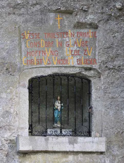
Lourdes Grotto Siwebaach Haller - Grotte Jamerbréck
Where? L-6370 Haller
During World War II, young Luxembourgers hid in a rock near the Siwebaach in Haller. After the war, they turned their bunker into a Lourdes grotto to thank the Virgin Mary for her protection.
The difficult life of Luxembourg's population during the Second World War, the persecution of members of resistance movements and their arrest, the conscription of young men into the Wehrmacht and their decision to desert while on home leave required places where the persecuted could hide.
One was looking for safe hiding places in the neighbourhoods of Ermsdorf, Haller and Medernach. In Haller, a rock was found in a dense, impenetrable spruce forest near several farms. Between 19 May and 10 September 1944, Luxembourgian refractory soldiers hid in the hollow rock. Soon, up to 12 young men were hiding in the bunker, so that it slowly became cramped and the bunker had to be extended. The expansion usually took place at night and the necessary steps were taken to avoid noise and sound and to remain undetected.
After a defenceless stay in a quarry, the desire to survive their stay in the bunker and to be able to return home happily after the war, the men decided to turn the bunker into a Lourdes grotto at the end of the war to thank the Virgin Mary for her protection. When Luxembourg was liberated by the Americans, the young men left the bunker and returned home. They honoured their promise and returned to their bunker in the post-war years and helped to build the grotto.
To reach the cave, you can leave your car at Haler Millen and then follow hiking trail W4 for 800 metres. Then turn right onto local hiking trail B7. After another 200 metres, you will reach the impressive cave.