Description
This circular hiking route connects the oldest city in Luxembourg with one of the region's geological highlights. There are two spectacular viewpoints on top. At times challenging.
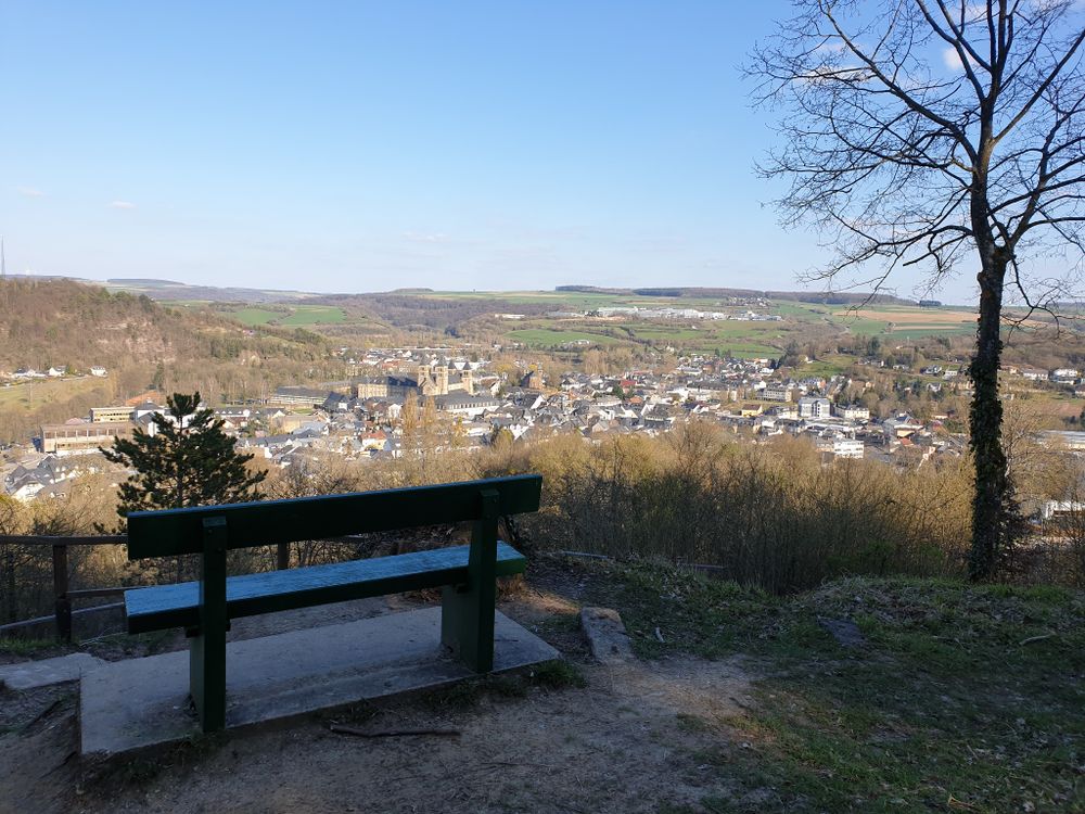
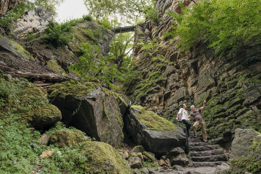
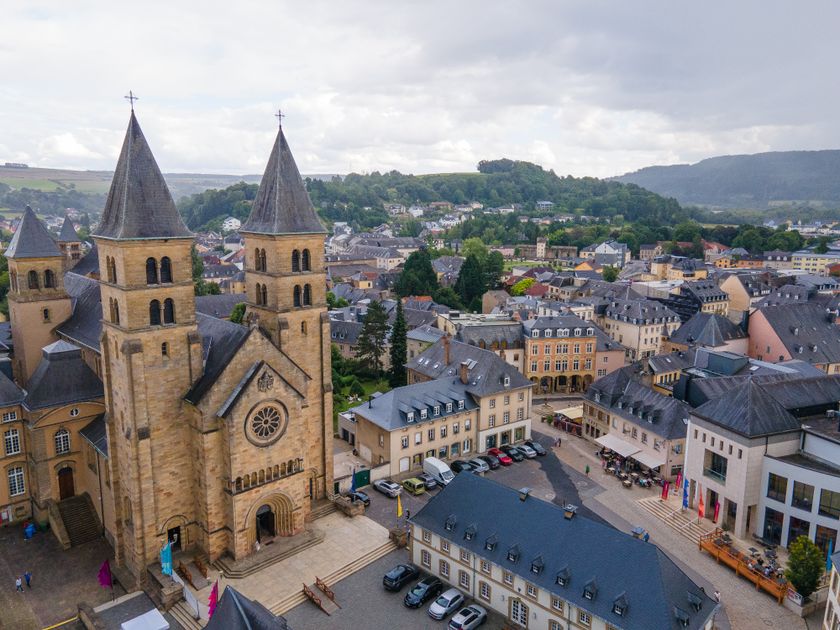
Starting right in the middle of Echternach's old town: at the basilica. The first (and most strenuous) ascent of the hike is rewarded with a unique view over Echternach. Shortly afterward follows the next highlight: the Wollefsschlucht. The Wollefsschlucht is a steep, smooth rock crevice through which the hiking trail winds. There is much to see and marvel at here.
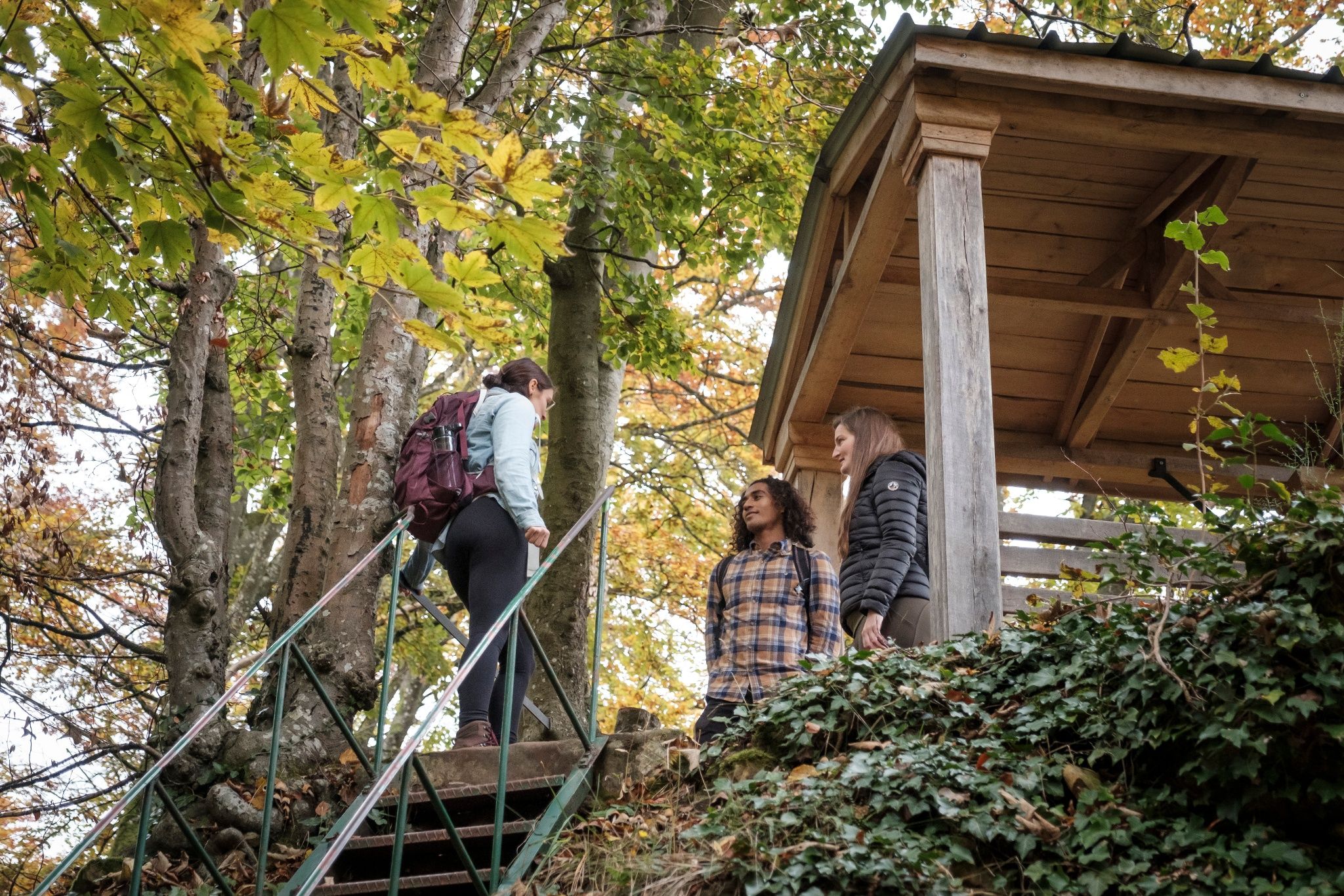
The route leads mostly through the forest in the first half. One should not miss the "Geierslee", a viewpoint with a wooden pavilion, from where you have a wide view over the Sauer valley.
From here the trail descends into the Sauer valley, along which it continues for a while. In the end, the path leads into Echternach's city park. Through the outer grounds of the former abbey, you return to the basilica.
The trail includes some more challenging sections, such as the climb to Troosnkneppchen, the stairs in the Wollefsschlucht, and the descent from the Geierslee.
Signposting

Directions
The local hiking trail E4 starts at the basilica in Echternach. You walk down Rue de la Gare and then turn left to climb steeply up the hill to Trooskneppchen. For the strenuous climb, you are rewarded with a unique view of Echternach. A little later, the second highlight of the route, the Wollefsschlucht, follows. The path then crosses the CR 364 a bit further on.
You reach the distinctive Geierslee and continue through the Spelzbësch towards the valley to Weilerbach. After crossing the N10, the path follows along the Sauer. Before reaching Echternach, you go uphill to the right and cross the N10 again. Then it continues along a small canal towards Echternach. You walk down the street Op Troo, and the path then leads into Echternach's city park. Through the outer grounds of the former abbey, you return to the basilica.
Equipment
Sturdy footwear and something to drink.
Journey
Nearest bus stop: Echternach, Gare
Parking:
Parking See (Nonnemillen) + take City-Navette to the city center.


 This website uses technology and content from the Outdooractive Platform.