©Visit Luxembourg
Müllerthal Germany France

Auto-Pédestre hiking route Echternach Centre

Starting point

Echternach: Basilica

Destination

Echternach: Basilica

Distance
6,71 km
Duration
2:00 h
Difficulty
medium
  • Condition
Highest point
295 Hm
Lowest point
157 Hm
Aggregated Ascent
140 Hm
Aggregated Descent
140 Hm
Circular routes Visit Luxembourg

Description

Refreshment stops available

This circular hiking route combines the old town charm of Echternach, impressive rock formations, rustic forests, and relaxation on the banks of the Sauer.

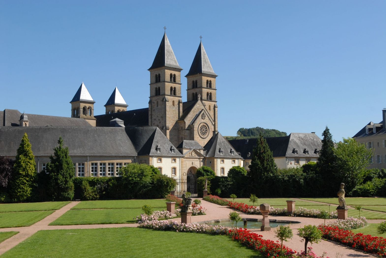
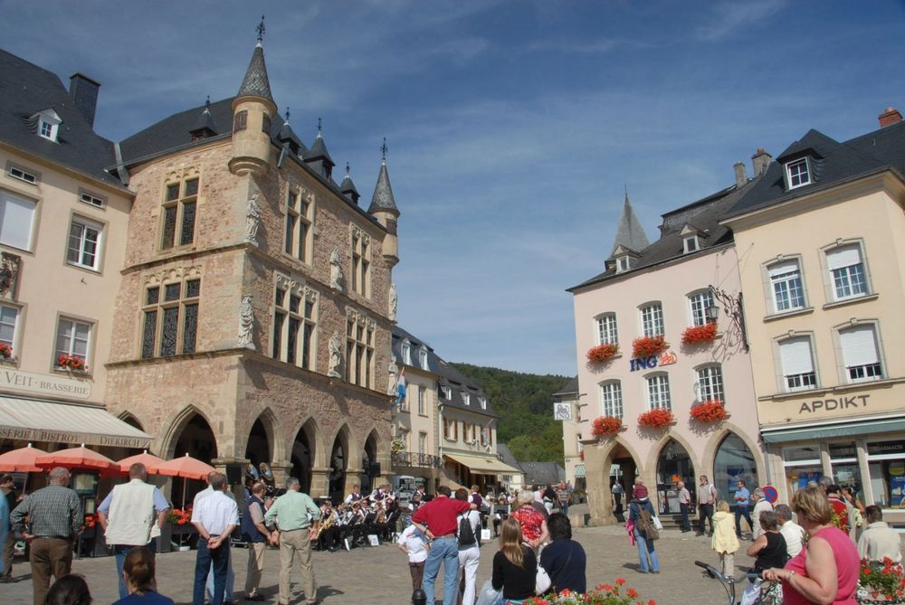
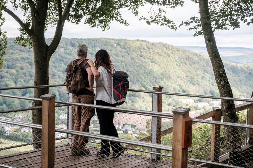
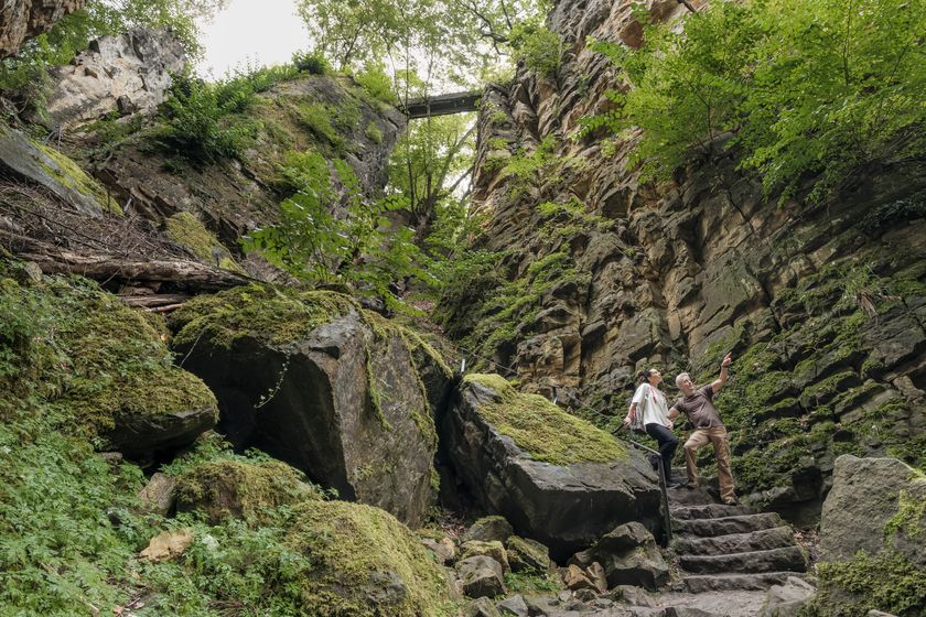
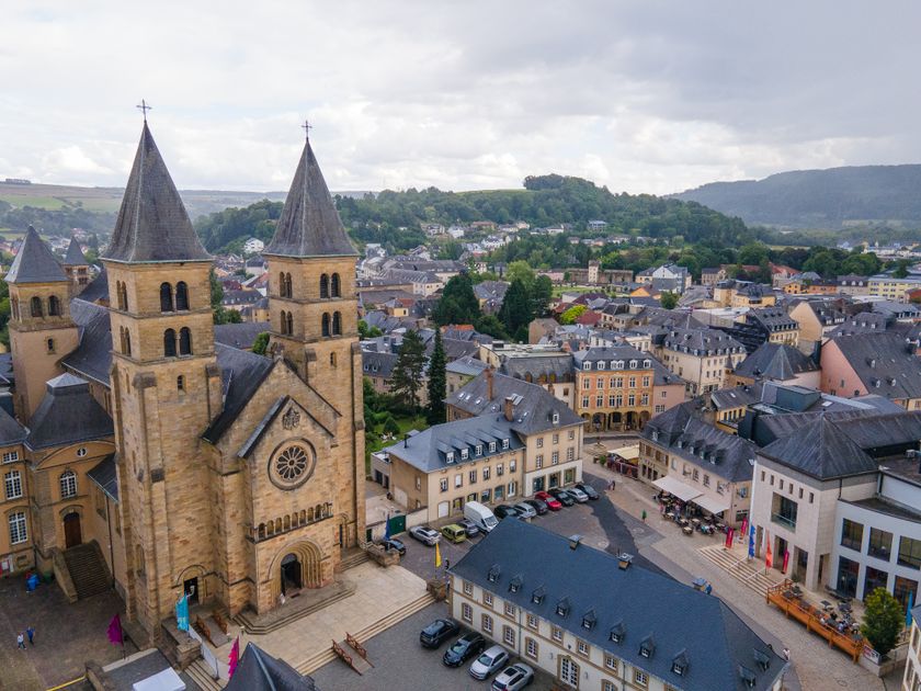
The hike starts right in the middle of Echternach's old town, at the basilica. The first ascent of the route is challenging and is rewarded with a spectacular view over Echternach from the so-called Trooskneepchen. The path continues through the forest to the impressive rock formation "Wollefsschlucht". You should allow enough time here to admire and explore. After crossing the Wollefsschlucht coming from Echternach, you can climb to the Paulsplatte to the left or to the "Bildcheslee" viewpoint on the right with views into the Sauer valley.

The second half of the route now leads downhill, first along the renatured Aesbaach down to the Sauer and then follows the river to the Echternach city park and back to the starting point.

Suggestions nearby

Auto-Pédestre hiking route Echternach Centre

  • ©Pancake! Photographie
    Picknick place Paulsplatte
    Picknick place Paulsplatte
    Find out more
  • ©Pancake! Photographie
    Rock formation "Wollefsschlucht"
    Imposing rock gorge with rock walls rising up to 50 m in height.
    Find out more
  • ©Anabela & Jorge Valente
    St. Willibrord Basilica Echternach
    St. Willibrord Basilica Echternach
    Find out more

Similar hiking tours

©Visit Luxembourg
Circular routes
Local hiking route - F2
Distance: 8,21 km
Duration: 2:30 h
Difficulty: medium
Find out more
©Visit Luxembourg
Circular routes
Auto-Pédestre hiking trail Junglinster
Distance: 9,17 km
Duration: 2:26 h
Difficulty: medium
Find out more
©Anne Lommel, Visit Luxembourg
Circular routes
Auto-pédestre trail Bourglinster
Distance: 7,28 km
Duration: 2:05 h
Difficulty: medium
Find out more
©Visit Luxembourg
Circular routes
Local hiking trail - J19
Distance: 6,86 km
Duration: 1:50 h
Difficulty: medium
Find out more
©Visit Luxembourg
Circular routes
Auto-Pédestre hiking route Fischbach
Distance: 11,10 km
Duration: 3:25 h
Difficulty: medium
Find out more
©Visit Luxembourg
Circular routes
Local hiking route - B9
Distance: 5,25 km
Duration: 1:30 h
Difficulty: medium
Find out more
©Visit Luxembourg
Circular routes
Local hiking route - B8
Distance: 11,95 km
Duration: 3:30 h
Difficulty: medium
Find out more
©Visit Luxembourg
Circular routes
Local hiking route - L5
Distance: 6,61 km
Duration: 2:00 h
Difficulty: medium
Find out more
©Visit Luxembourg
Circular routes
Local hiking trail - M1
Distance: 8,22 km
Duration: 2:25 h
Difficulty: medium
Find out more
outdooractive This website uses technology and content from the Outdooractive Platform.