Hunting Season 2026/27 — Check for hunts

Autumn is here, and that means hunting season has begun! From mid-October to January/February, hunters are active across the country. Stay safe by checking hunt dates in your area on our Map. 

Click on Map in the Header > Services > More > Hunting.

Starting point

Pavilion Junglinster sports center on the N11

Destination

Pavilion Junglinster sports center on the N11

Distance
13,10 km
Duration
3:28 h
Difficulty
medium
  • Condition
Highest point
430 Hm
Lowest point
335 Hm
Aggregated Ascent
136 Hm
Aggregated Descent
136 Hm
Circular routes Visit Luxembourg

Description

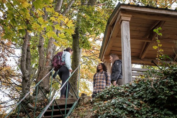
The Dujangsbrak hiking trail runs through the Grünewald and offers a varied mix of fields, forests, and historical references.

-Sentier Dujangsbrak-

The hiking trail Dujangsbrak got its name from the same called place in the middle of the Grünewald forest. It is possible that there was a lumberjack´s hut here in the Middle Ages, because the Grünewald was a wood and charcoal supplier for the fortress of Luxembourg and the ironworks of Eich.
The trail leads through the Northern part of the former grand ducal area and offers a good mix of fields and forests. The trail is also suitable for jogging.

Suggestions nearby

Local hiking trail - J4

  • Playground - Op de Fréinen
    Playground - Op de Fréinen
    Find out more
  • Playground - rue Tun Deutsch
    Playground - rue Tun Deutsch
    Find out more
  • Playground - Op der Tonn
    Playground - Op der Tonn
    Find out more
  • Playgorund - Cité Breidlecker
    Playgorund - Cité Breidlecker
    Find out more

Similar hiking tours

©Visit Luxembourg
Circular routes
Local hiking trail - J23
Distance: 8,37 km
Duration: 2:12 h
Difficulty: medium
Find out more
©Visit Luxembourg
Circular routes
Local hiking trail - J21
Distance: 5,21 km
Duration: 1:22 h
Difficulty: medium
Find out more
©Visit Luxembourg
Circular routes
Local hiking trail - J14
Distance: 14,58 km
Duration: 3:59 h
Difficulty: medium
Find out more
©Visit Luxembourg
Circular routes
Local hiking trail - J9
Distance: 10,97 km
Duration: 2:45 h
Difficulty: medium
Find out more
©Visit Luxembourg
Circular routes
Local hiking trail - J17
Distance: 11,02 km
Duration: 2:50 h
Difficulty: medium
Find out more
©Visit Luxembourg
Circular routes
Local hiking trail - L1
Distance: 2,25 km
Duration: 0:45 h
Difficulty: medium
Find out more
©Visit Luxembourg
Circular routes
Local hiking trail - C6
Distance: 5,88 km
Duration: 1:40 h
Difficulty: medium
Find out more
©ORTMPSL, ORTMPSL
Circular routes
Local hiking trail - B4
Distance: 6,13 km
Duration: 1:50 h
Difficulty: medium
Find out more
©Pancake! Photographie, Visit Mullerthal
Circular routes
Local hiking trail - E4
Distance: 10,99 km
Duration: 3:20 h
Difficulty: medium
Find out more
outdooractive This website uses technology and content from the Outdooractive Platform.