Starting point

Godbrange: Pavilion by the church

Destination

Godbrange: Pavilion by the church

Distance
11,01 km
Duration
2:59 h
Difficulty
medium
  • Condition
Highest point
410 Hm
Lowest point
294 Hm
Aggregated Ascent
181 Hm
Aggregated Descent
181 Hm
Circular routes Visit Luxembourg

Description

Local hiking trail - J20

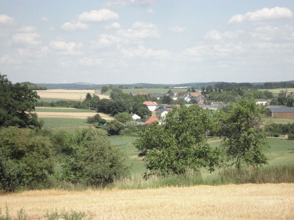
The Blummendaller Pad is a culture and nature trail starting at the pavilion in Godbrange. It runs via the elevations Schiltzbierg and Koon through the fields of Räiländer-Bann down to the village of Blumenthal. Through the scenic Jean-Haris-Gronn valley with its lush stream meadows and the gloomy forest Schwäibësch along the watercourse, the path leads to a romantic pond in the forest. After a rest on the shady shore, you continue past steep rocks up to Koon. The so-called Rennpad takes you back to Schiltzbierg. After a visit of the forester's straw house office, you walk back to the Godbrange pavilion through the meadow valley.

Similar hiking tours

©Visit Luxembourg
Circular routes
Auto-pédestre trail Grundhof
Distance: 10,99 km
Duration: 3:15 h
Difficulty: medium
Find out more
©Visit Luxembourg
Circular routes
Local hiking trail - B10
Distance: 4,99 km
Duration: 1:20 h
Difficulty: medium
Find out more
©Visit Luxembourg
Thematic paths
Memorial Route
Distance: 20,46 km
Duration: 5:40 h
Difficulty: medium
Find out more
©L. Schömer, Visit Luxembourg
Circular routes
Local hiking trail - B19
Distance: 10,21 km
Duration: 3:05 h
Difficulty: medium
Find out more
©Visit Luxembourg
Mullerthal Trail - Leading Quality Trails - Best of Europe
Mullerthal Trail ExtraTour C
Distance: 9,34 km
Duration: 2:45 h
Difficulty: medium
Find out more
©Visit Luxembourg
Circular routes
Local hiking trail - J19
Distance: 6,86 km
Duration: 1:50 h
Difficulty: medium
Find out more
©Pancake! Photographie, Visit Luxembourg
Mullerthal Trail - Leading Quality Trails - Best of Europe
Mullerthal Trail Route 1
Distance: 36,74 km
Duration: 10:25 h
Difficulty: medium
Find out more
©Visit Luxembourg
Circular routes
Auto-Pédestre hiking route Fischbach
Distance: 11,10 km
Duration: 3:25 h
Difficulty: medium
Find out more
©Visit Luxembourg
Circular routes
Local hiking trail - B9
Distance: 5,25 km
Duration: 1:30 h
Difficulty: medium
Find out more
outdooractive This website uses technology and content from the Outdooractive Platform.